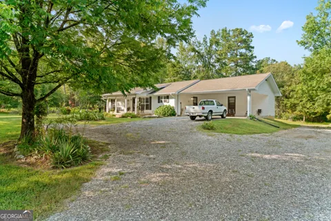
Blue Ridge Foothills Town
For Sale in Cohutta, GA
Welcome to Cohutta, a small Whitfield County town in the Blue Ridge foothills near the Tennessee line, minutes from Dalton and a gateway to the Cohutta Wilderness.
Cohutta is a town in Whitfield County, Georgia, situated in the northwestern corner of the county in the foothills of the Blue Ridge Mountains, about five minutes south of the Tennessee border. It is part of the Dalton, Georgia metropolitan statistical area and lies roughly halfway between Dalton and Cleveland, Tennessee. With a population of roughly 900, it is a small community whose setting places it at the edge of some of north Georgia's most expansive public land. The town's name comes from a Cherokee word meaning "foggy weather," a fitting reference to the misty valleys of the surrounding foothills. Historically, Cohutta served as a shakerag stop along the route between Cleveland, Tennessee, and Dalton, Georgia, reflecting its early role as a waypoint in the region's railroad and agricultural economy. That heritage as a small crossroads town continues to shape its character today. Cohutta's most significant natural asset is its proximity to the Cohutta Wilderness, a 37,000-acre federally designated wilderness area within the Chattahoochee-Oconee National Forest. The wilderness contains about 90 miles of hiking and backpacking trails, including routes that follow the Jacks and Conasauga rivers, and it is regarded as one of the premier destinations for remote backcountry hiking in the Southeast. Peaks in the surrounding Cohutta Mountains rise above 4,000 feet, giving the town a distinctly mountainous backdrop despite its low-elevation setting. Education is provided by the Whitfield County School District, which serves the areas of the county outside the Dalton city limits, including Cohutta, and operates Cohutta Elementary School in town. The district enrolls more than 13,000 students across 24 schools. Transportation runs along the Cleveland Highway corridor and U.S. 411, with Interstate 75 through Dalton providing regional access toward Chattanooga and Atlanta. For residents, Cohutta combines a small, quiet foothills setting with convenient access to Dalton's employment and services and to the outdoor recreation of the national forest.
Frequently Asked Questions
What county is Cohutta in?
Cohutta is a town in Whitfield County, Georgia, located in the northwestern corner of the county in the foothills of the Blue Ridge Mountains. It is part of the Dalton, Georgia metropolitan statistical area.
What does Cohutta mean?
The name Cohutta comes from a Cherokee word meaning 'foggy weather,' reflecting the town's setting in the Blue Ridge foothills near the Tennessee border. Cohutta was once a shakerag stop between Cleveland, Tennessee, and Dalton, Georgia.
What school district serves Cohutta?
Students in Cohutta are served by the Whitfield County School District, which operates Cohutta Elementary School in town. The district serves the areas of Whitfield County outside the Dalton city limits, including Cohutta, and enrolls more than 13,000 students across 24 schools.
What is the Cohutta Wilderness?
The Cohutta Wilderness is a 37,000-acre federally designated wilderness area in the Chattahoochee-Oconee National Forest. It contains about 90 miles of hiking and backpacking trails, including trails that follow the Jacks and Conasauga rivers, and is a popular destination for remote backcountry hiking in north Georgia.
How far is Cohutta from Dalton and Chattanooga?
Cohutta sits roughly halfway between Dalton, Georgia, and Cleveland, Tennessee, in the northwest corner of Whitfield County, about five minutes from the Tennessee state line. U.S. 411 runs nearby, and Interstate 75 through Dalton provides access to Chattanooga and Atlanta.
MARKET SNAPSHOT
The Market at a Glance
How homes have been selling here over the last 90 days.
Price & Sales History
Market data reflects closed sales over the last 90 days and is provided for informational purposes.
BROWSE BY ZIP
Zip Codes
Browse listings by postal code in this area.
- Grid
- Map
- List